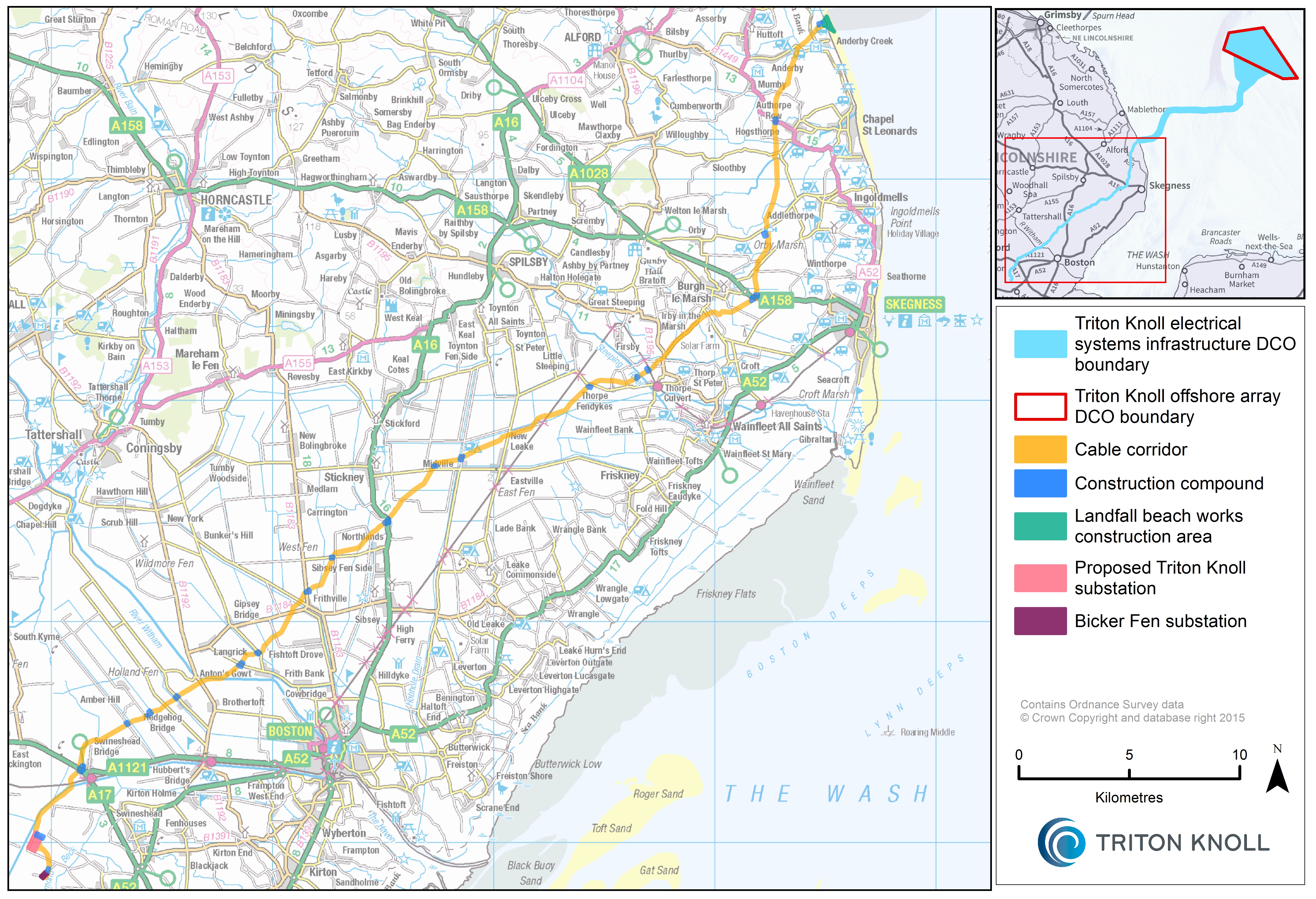
This page provides you with a map of the Onshore Electrical System infrastructure, including the landfall site to the north of Anderby Creek, the 57km onshore cable route to the new substation site at Bicker, and the connection point to the existing National Grid substation at Bicker Fen.
For a detailed view, click here to download a high resolution version of the map.
